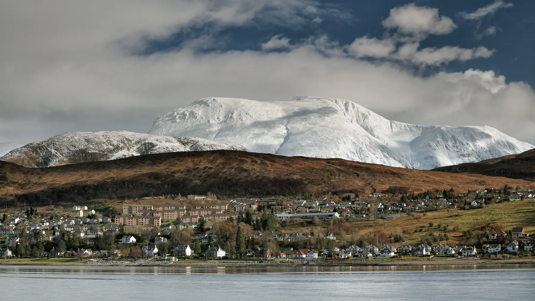
Ben Nevis is 1,345 metres high, it is the highest mountain in Britain, and something like 150,000 people go up it every year. Most of them get to the top and back without difficulty. A significant minority do not, and Lochaber Mountain Rescue is one of the busiest teams in the country.
The gap between those two groups is almost never fitness. It is preparation, timing and, above all, navigation on the summit plateau. This guide is written to close it.
The Ben sits at the head of Glen Nevis, four miles from Fort William. From the town you see a broad, unremarkable dome; the mountain’s real face is on the other side, where a wall of cliffs nearly 700 metres high curves around the north-east corrie and provides some of the finest rock and winter climbing in Britain.
The summit plateau carries the ruins of the observatory that operated continuously from 1883 to 1904, taking hourly readings in conditions that are difficult to imagine. Its records still underpin a good deal of what is known about British mountain weather. The plateau holds snow into the summer, and the summit averages only around two weeks of clear conditions a year.
Almost everyone uses the Mountain Track, sometimes still called the Pony Track or, misleadingly, the Tourist Route. It was built in the 1880s to service the observatory, and it is a constructed path the whole way — no scrambling, no exposure, no route-finding difficulty in clear weather.
It starts either at the Glen Nevis visitor centre (a footbridge and a steep initial climb) or at Achintee, on the north side of the river by the Ben Nevis Inn. The two join within twenty minutes.
From there the path climbs steadily to the halfway lochan at about 570 metres, crosses the Red Burn, and then begins the long series of zig-zags up the western flank to the plateau. The last section is a boulder field.
Distance: about 17 kilometres round trip. Ascent: roughly 1,350 metres from the glen. Time: seven to nine hours for most people. Fit walkers do it in five or six; plenty of people take ten.
It is a long, relentless, unglamorous slog rather than a technical challenge, and the descent is harder on the knees than the ascent is on the lungs.
Navigation on the summit plateau.
The plateau is broad, flat and featureless, and it is in cloud most of the time. On the northern and eastern edges it drops into Five Finger Gully, Gardyloo Gully and the great cliffs of the north face, and cornices overhang those edges well into spring. People walking off the plateau in poor visibility have died there in every decade for which records exist.
The safe descent requires two specific compass bearings from the summit cairn, taken in sequence with a measured distance between them, to avoid the gullies. These bearings are published by the mountain rescue team and printed on the Harvey and Ordnance Survey maps of the mountain. If you do not know how to follow a bearing on a compass, do not go up in conditions where you might need to.
A phone is not a substitute. Batteries fail in the cold, screens fail in the wet, and GPS accuracy on a plateau is not what people assume.
Boots with ankle support and a decent sole. Trainers are the single most common item on the rescue team’s list of complaints.
Waterproof jacket and trousers, regardless of the forecast in the town.
Warm layers. The summit is roughly nine degrees colder than the glen, before wind chill. It can be below freezing in July.
Hat and gloves, in any month.
Map and compass, and the knowledge to use them.
Head torch, even in summer. People routinely misjudge the descent.
Food and at least two litres of water. There is nothing on the mountain.
A charged phone, as a backup and not a plan.
Start early — by eight at the latest in summer, earlier if you are slow. The commonest cause of trouble is running out of daylight.
Check the mountain forecast, not the Fort William one. The Mountain Weather Information Service and the Met Office mountain forecasts both cover the west Highlands and both give a freezing level and a cloud base, which are the two numbers that matter.
Best months: June to September for walkers. Snow lies on the upper mountain from roughly November to May, sometimes later, and the path disappears under it.
From late autumn to late spring, Ben Nevis is a full winter mountaineering objective. Snow and ice cover the path, the plateau cornices, avalanche risk is real, and daylight is short. It requires an ice axe, crampons, the skills to use both, and avalanche awareness.
Every winter people set off up the Mountain Track in walking boots because it was fine in August. Do not be one of them. If you want the mountain in winter, hire a guide — several Fort William operators run winter skills courses and guided ascents, and they are excellent.
The Càrn Mòr Dearg Arête is the classic mountaineer’s approach: up Càrn Mòr Dearg and along a narrow, exposed granite ridge to the summit, with the north face cliffs beside you the whole way. It is a scramble with serious consequences and requires a head for heights and mountain experience. Superb in good conditions, and no place to be otherwise.
The north face carries dozens of rock and ice climbs and is one of the most important winter climbing venues in the world. The CIC Hut below the cliffs is Britain’s only alpine-style climbing hut.
The single best piece of advice about Ben Nevis is that it will still be there next year. If the forecast is poor, the alternatives are genuinely good:
Our walks guide has the full set.
Parking at the Glen Nevis visitor centre is charged and fills early; there is limited parking at Achintee and at the Ben Nevis Inn for patrons.
Toilets at the visitor centre. Nothing above it — and the mountain has a genuine problem with human waste and litter. Take everything down with you, including tissue.
The Ben Nevis Inn at Achintee is where everyone eats afterwards.
Charity walks put large numbers of inexperienced people on the mountain on certain weekends, often finishing in the dark. If you value solitude, check before you pick your date.
Three Peaks attempts arrive at unsocial hours and generally go up in the dark. If you are doing one, the same navigation advice applies twice over.
A small thing that makes a real difference. Staying in Glen Nevis rather than in the town puts you at the trailhead: there is a campsite and caravan park, a youth hostel, a bunkhouse and several guesthouses along the glen road, and the Ben Nevis Inn at Achintee has bunkhouse accommodation directly beneath the restaurant, about a hundred metres from the start of the path.
Waking up at the foot of the mountain, eating breakfast and walking out of the door onto the track is worth an hour of daylight and a good deal of stress. Most of these fill months ahead for summer weekends.
Seven to nine hours round trip for most people on the Mountain Track, though it ranges from five to ten.
In summer, in good weather, on the Mountain Track: no technical experience, but real hill fitness and the ability to navigate if cloud comes down. In winter: yes, full winter mountaineering skills.
It is long and relentless rather than technically difficult. The difficulty is the weather and the summit plateau navigation.
Fit older children do, with experienced adults and in settled conditions. It is an eight-hour day with no escape route in the middle.
Cold, wet and cloudy most of the time. The summit averages around two weeks of clear conditions a year and can be below freezing in any month.
No. There is nothing on the mountain at all. Carry everything.