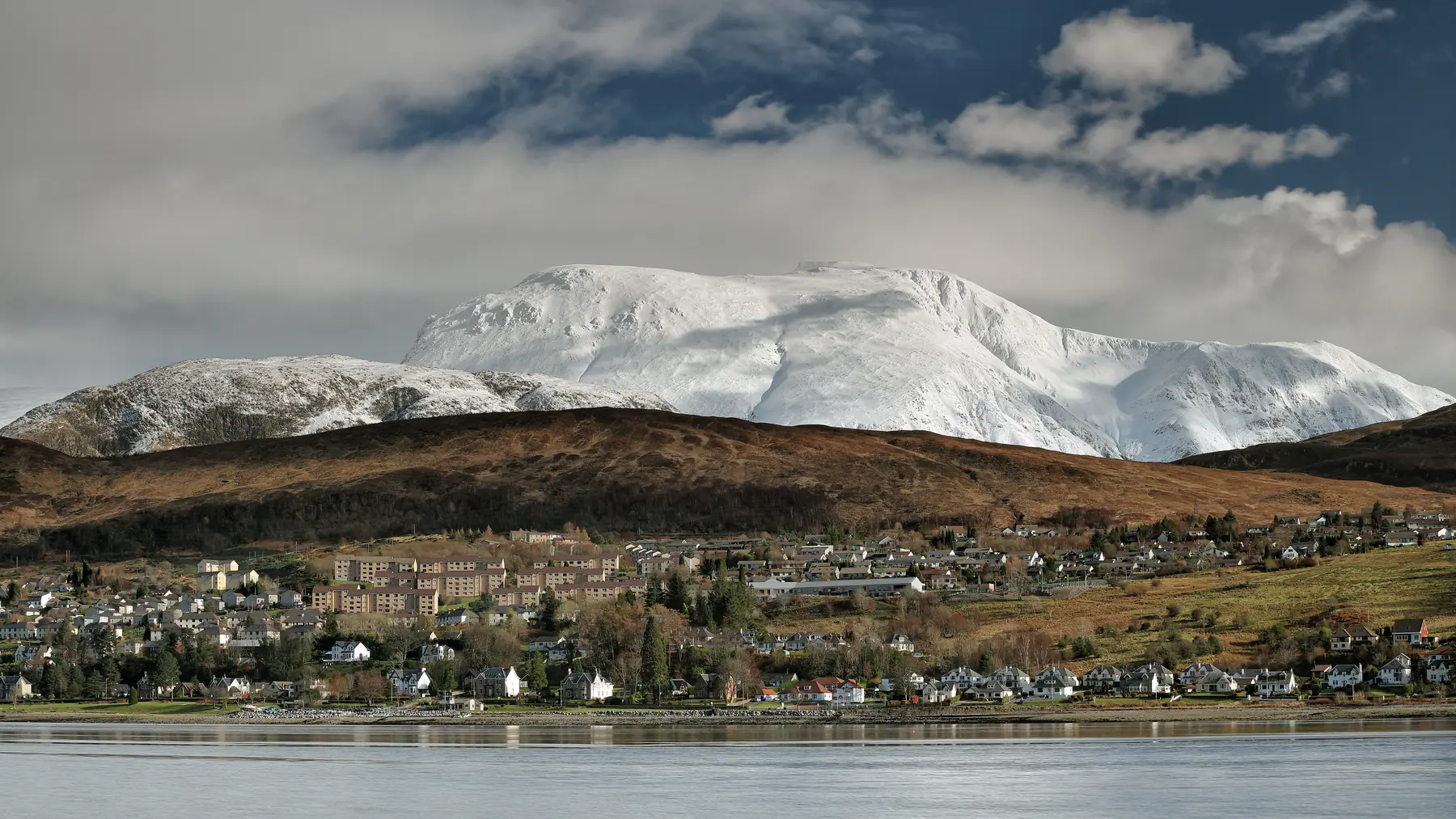
Fort William calls itself the Outdoor Capital of the UK, and for once the marketing is defensible. The town sits at the foot of the Great Glen on the shore of a sea loch, with Britain’s highest mountain immediately behind it, Glen Coe half an hour south, the Mamores and the Grey Corries to the east, and two of Scotland’s great long-distance paths finishing on its high street.
It is also a town where a great many people arrive intending to climb Ben Nevis and discover that the weather has other ideas. This guide is arranged accordingly: the low-level walks first, because they are what you will actually do on at least half the days you are here.
Distances are from the town centre.
The glen behind the town is the best low-level walking in the western Highlands and most of it needs no mountain experience at all.
From the visitor centre, a path follows the River Nevis up the glen through woodland and open meadow, with the mountain on one side and the Mamores on the other. Flat, easy and beautiful, and you can walk as far up as you like and turn round.
Seven kilometres up the glen by road, the Lower Falls are a set of rapids and pools where the river drops over a rock band beside a bridge. There is parking, it takes five minutes to reach, and it is one of the most photographed spots in Lochaber.
The classic. From the car park at the head of the glen road, a path climbs through the Nevis Gorge — a genuinely dramatic wooded ravine with the river hammering through boulders below — and emerges into a hanging valley with Steall Waterfall dropping 120 metres down the far wall. It is Scotland’s second-highest waterfall and the meadow below it is one of the great surprises of the Highlands.
The walk is about an hour and a half round trip. It is rocky, exposed in places and slippery when wet, and it is not the gentle stroll the distance suggests. A wire rope bridge crosses the river to the foot of the falls; crossing it is optional and, in wind or spate, inadvisable. See our Steall Waterfall page.
An Iron Age vitrified fort on a spur above the glen, reached by forest track from the youth hostel. Around two hours round trip with a steady climb, and the view down the glen from the fort is superb. Almost nobody goes.
The small hill directly behind the town, reached from the end of Lundavra Road or from Glen Nevis. It is a couple of hours round trip on a good track and gives you Fort William, Loch Linnhe, the Great Glen and Ben Nevis in one turn — the best view-to-effort ratio in the area by a wide margin.
Fifteen kilometres south at Glencoe village. A small artificial loch surrounded by North American conifers, planted in the 1890s by Lord Strathcona to remind his Canadian wife of home. Three waymarked trails of thirty to sixty minutes, flat, sheltered and lovely, with the Pap of Glencoe reflected in the water.
Twelve kilometres south at Onich, a set of waterfalls reached by a short forest walk with a viewing platform. Half an hour, and worth stopping for on the way to Glencoe.
Three kilometres north at Banavie, Thomas Telford’s staircase of eight locks lifts the Caledonian Canal twenty metres in a quarter of a mile — the longest staircase lock in Britain, built between 1803 and 1822. Watching a yacht work through it takes about an hour and a half and is oddly compelling.
The towpath runs from Corpach sea lock north-east along the canal towards Gairlochy, flat, surfaced and open to walkers and cyclists, with Ben Nevis behind you and the Great Glen ahead. It is the best easy walking near the town and it is part of the Great Glen Way. See our Neptune’s Staircase page.
At Corpach, the canal reaches the sea, and on the shore at Caol there is a beached wooden boat that has become one of the most photographed objects in Scotland, with Ben Nevis directly behind it. It is free, it takes ten minutes, and it is a five-minute drive or a walk along the shore from the town.
Two kilometres north, a thirteenth-century courtyard castle with four round towers on the bank of the River Lochy — the original settlement here before the fort and the town moved south. Free to look at from outside; access to the interior has been restricted at times for safety.
The West Highland Way ends in Fort William after 154 kilometres from Milngavie near Glasgow, and the sculpture marking the official end sits on the High Street. The final stage, over the moor from Kinlochleven, is one of the best days on the route.
The Great Glen Way runs 127 kilometres from Fort William to Inverness along the canal and the lochs, and starts at the same point. The first section along the canal to Gairlochy is flat and easy and makes a good day walk in its own right.
Both are well served by buses and by the West Highland Line, so day sections with transport back are straightforward.
Ben Nevis has its own guide — see climbing Ben Nevis — and needs to be treated as the serious mountain it is.
Beyond it, the Mamores above Kinlochleven, the Grey Corries, Aonach Eagach in Glen Coe and the Ring of Steall are all classic Scottish mountain days, and all of them require proper equipment, navigation and a forecast. The Nevis Range gondola at Aonach Mòr, ten kilometres north-east, gives access to high ground without the climb and has walking trails at the top.
Weather. Fort William is one of the wettest places in Britain and the mountains make their own conditions. Check a mountain forecast, not a town one, and expect the summits to be in cloud a large proportion of the time.
Midges from June to September, worst in still conditions near water and in the woods. Repellent, a head net and a breeze are the answers.
Parking. Glen Nevis has car parks at the visitor centre, Lower Falls and the head of the glen; the last of these fills early in summer. In town, Morrisons, the station, the Nevis Centre and the West End car park are all free.
Buses run up Glen Nevis in season and south to Glencoe and Kinlochleven, which makes linear walks possible.
Ticks are present in the bracken and long grass from spring to autumn. Check afterwards.
Fort William is where two of Scotland’s great walking routes meet, and the town has a particular atmosphere because of it. On any summer afternoon there are people arriving on the High Street who set out from Milngavie eight days earlier, and there are people setting off north who will reach Inverness in a week. Both routes start and end at the same sculpture.
The practical use of this for a visitor with a few days is that both routes have excellent day sections with public transport at either end. The final stage of the West Highland Way, from Kinlochleven over the old military road and down into Glen Nevis, is about twenty-four kilometres of superb high moorland walking with a bus back from Kinlochleven at the start. The first stage of the Great Glen Way, from the town along the canal to Gairlochy, is sixteen kilometres of flat towpath with a bus back down the A82.
Between them they give you the two extremes of Highland walking — exposed moor and sheltered canal — in the same week, without a car.
Steall Falls through the Nevis Gorge for drama, Cow Hill for the view, the canal towpath for an easy day.
About an hour and a half round trip from the car park at the head of the Glen Nevis road, on a rocky and sometimes slippery path.
Yes — the Caledonian Canal towpath, the lower Glen Nevis riverside, Glencoe Lochan and the shore at Corpach.
In Fort William, at the sculpture on the High Street, after 154 kilometres from Milngavie.
Not for Glen Nevis in season or for the canal, both of which are walkable or on a bus route. For Glencoe and the outlying glens it helps.