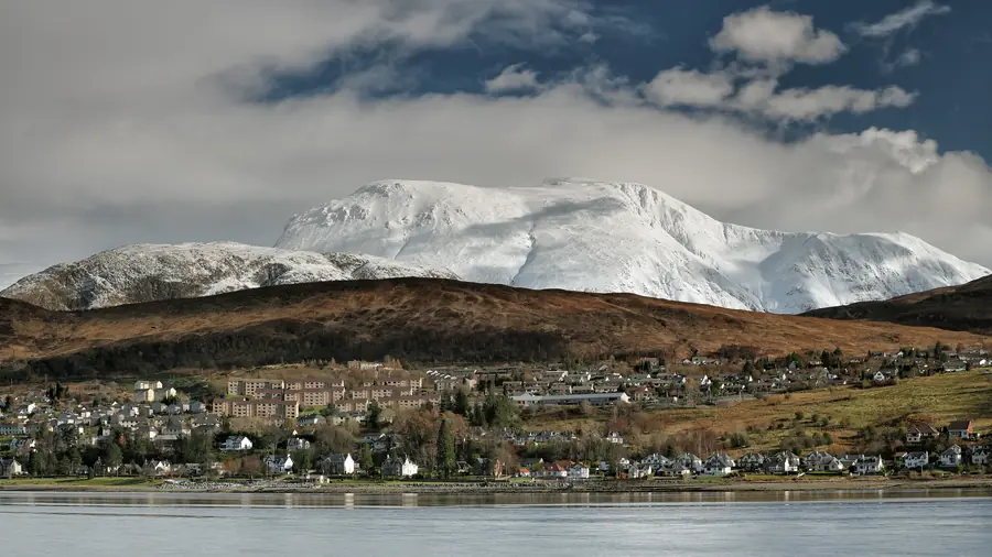
Ben Nevis rises directly behind Fort William to 1,345 metres, the highest point in the British Isles.
It is climbed by something in the order of 150,000 people a year, most by the Mountain Track from Glen Nevis, and it is at once entirely achievable by a fit adult with no mountaineering experience and considerably more serious than most of those people expect.
The name is usually given as Beinn Nibheis — often rendered “venomous mountain” or “mountain with its head in the clouds”, both of which are defensible and both of which are apt.
The southern side, which faces Fort William, is a long convex slope of grass and scree. The north face is something else entirely: a two-kilometre wall of cliffs up to 700 metres high, one of the great arenas of British mountaineering and the place where much of the country’s winter climbing was invented.
Almost nobody who walks up the tourist route sees the north face at all, which is the mountain’s private joke.
The Mountain Track — historically the Pony Track, and please not the “tourist path”, which flatters it — starts at the Glen Nevis Visitor Centre or from Achintee.
Distance: about 17 kilometres return. Ascent: about 1,350 metres. Time: seven to nine hours for most people. Fast walkers do it in five; plenty take ten.
The path is rough, rocky and relentless. It zigzags up to the Halfway Lochan, traverses, then climbs a long series of stone zigzags across boulder-strewn ground to the summit plateau. There is no technical difficulty and no scrambling. There is a great deal of uphill on uneven stone, and the descent is harder on the legs than the ascent.
The summit is in cloud roughly two days in three. The plateau is a wide field of boulders with the ruined observatory, an emergency shelter, and a trig point on a cairn.
In cloud it is dangerous. The plateau is flat enough that the edge is not obvious, and two gullies — Five Finger Gully and Gardyloo Gully — have killed walkers who drifted off the line on the descent. The standard advice is to carry a map and compass and know how to use them, because the correct descent bearings are specific and GPS alone is not a substitute in a whiteout.
Snow lies on the summit into June most years, and often longer. Snow patches survive some summers entirely.
Start early — before eight in summer.
Take more clothing than the weather at the car park suggests. The summit is typically 9°C colder than Fort William, and often windy with it.
Take food, water, a head torch, waterproofs and a map. People are rescued from Ben Nevis every week of the season, and the great majority are simply underequipped.
Check the mountain forecast, not the town forecast.
In winter this is a mountaineering route, requiring ice axe, crampons and the skill to use them. It is not a winter walk.
Free.
Parking: the Glen Nevis Visitor Centre car park is the main one, and it is charged and fills by early morning in summer. There is overflow parking in the glen.
Facilities: visitor centre, toilets, café at the start. Nothing on the mountain.
The Ben Nevis Race is run each September; the record is under 85 minutes for the round trip, which is worth bearing in mind at hour five.
Seven to nine hours return for most walkers, on a 17-kilometre route with 1,350 metres of ascent.
Not technical experience, but you need hill fitness, proper boots, warm and waterproof clothing, food, water and navigation. In winter it is a full mountaineering route.
The summit is in cloud around two days in three. Pick your day if the view matters.
Usually into June, and sometimes all year in the gullies.
At the Glen Nevis Visitor Centre or Achintee, on the Fort William side of Glen Nevis.