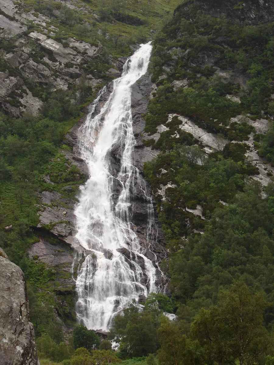
An Steall Bàn — “the White Spout” — falls 120 metres from a hanging valley into upper Glen Nevis, and it is the second-highest waterfall in Scotland.
It is reached by a walk of about 1.5 kilometres each way from the car park at the head of the Glen Nevis road, through the Nevis Gorge, and it is the best short walk in the Fort William area by a wide margin.
The path is the point as much as the falls.
It leaves the car park and immediately enters the Nevis Gorge, a steep-sided ravine where the river drops through a chaos of boulders under old Scots pine, birch and oak. The path is cut into the side of it, climbing and traversing, with the river below and rock above.
It is frequently compared to Himalayan gorge country, and while that is a stretch, the sense of enclosure and scale is genuine and unlike anywhere else in Britain.
The land is owned by the John Muir Trust, which manages it for its wilderness qualities — which is why there are no handrails, no steps and no interpretation boards.
This is a hill path, not a stroll. It is rocky throughout, it climbs and drops, it is slippery when wet, and there is a steep drop to one side for much of the way with nothing between you and it.
It takes most people forty minutes to an hour each way. It is entirely manageable for anyone reasonably fit in proper boots, and it is not manageable in trainers, in the dark, or with a toddler on your shoulders.
Then the gorge opens without warning into the Steall Meadows — a flat green floor with the river meandering across it and the waterfall directly ahead. The transition is abrupt and is the reason people remember the walk.
Across the river below the falls is a three-wire bridge: one wire to walk on, two to hold.
It leads to Steall Hut and to the foot of the fall itself. Crossing it is optional, unprotected, and considerably harder than it looks, particularly when the wires are wet or the river is high. You do not need to cross it — the view of the waterfall from the meadow side is complete.
People do cross it, in numbers, and people also fall off it. Treat it as a serious decision rather than a photo opportunity.
Free, open at all times.
Parking: the car park at the head of the Glen Nevis road is small and fills early in summer — by mid-morning on a good day. It is a single-track road with passing places for the last stretch.
Time: two to three hours for the return walk with time at the falls.
Facilities: none at the upper car park. Glen Nevis has a visitor centre, campsite and café lower down.
Gear: boots, waterproofs, and something warm. There is no phone signal for much of the glen.
Access: not accessible. There is no easy alternative view of the falls.
Water: the river pools below the falls are used for wild swimming and are extremely cold.
Lower Falls, on the way up the glen, is a roadside cascade with pools and needs no walk.
Ben Nevis — the mountain path starts from Glen Nevis lower down, at the visitor centre.
The Glen Nevis road itself is one of the best short drives in Scotland.
About 1.5 kilometres each way, forty minutes to an hour in each direction, on rocky ground.
It is a hill path with rocky going and a steep drop to one side. It needs proper footwear and reasonable fitness, but no technical skill.
No. The waterfall is fully visible from the meadow on the near side. The bridge is unprotected and harder than it looks.
120 metres — the second highest in Scotland.
A small car park at the head of the Glen Nevis road, which fills by mid-morning in summer.